Principle and function of drone image transmission module
2024年11月12日Smartphone USB Thermal Imaging Camera For Android Mobile Phone
2024年12月6日Wildlife are an important part of the natural ecosystem, and their protection is related to global ecological health and security.

The first step in wildlife conservation is to investigate species populations, understand species distribution, population size, habitat changes, etc., and provide a scientific basis for further assessing species quality of life, determining protection levels, and developing appropriate protection strategies. However, this important basic work is extremely difficult to achieve in mountainous forest areas.
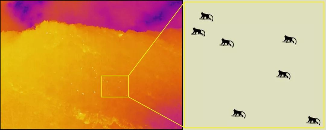
Recently, the Qinling Golden Monkey Research Team of the School of Life Sciences of Northwest University used drones and thermal imaging technology to investigate the distribution and population size of wild Sichuan golden monkeys in the Qinling area. The research team collected thermal imaging videos of three groups of wild Sichuan golden monkeys in the survey area and obtained the accurate distribution location and population size of these populations.
What are the traditional wildlife survey methods?
He Gang, an animal protection expert at the Shaanxi Qinling Key Laboratory for Conservation of Rare and Endangered Animals, introduced that traditional wildlife surveys usually involve experienced investigators entering the survey area and conducting field surveys along designed sample lines. They judge the distribution and scale of species by manually observing and recording the animal entities and traces found along the routes they pass.
However, in mountainous forest areas, investigators first have to face the problem of long, rugged and dangerous roads; secondly, investigators move slowly, making it difficult to find and locate animals; in addition, using only visible light, it is difficult to separate animals from the environment in which they are hiding, and it is difficult to observe each individual. This greatly affects the accuracy and efficiency of wildlife surveys. He Gang said that drones and thermal imaging technology have brought new opportunities to change this situation. The combination of the two technologies can effectively solve the difficulties that are difficult to overcome in traditional survey methods.
Combining drones and thermal imaging technology
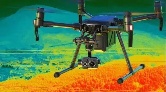
He Gang introduced that drone technology can overcome the limitations of terrain and vision, and thermal imaging technology can detect individual animals through the temperature difference between animals and the environment.
- The drone can fly quickly on the canopy, eliminating the problems of terrain and vegetation obstruction faced when moving on the ground, and realize free movement. At the same time, in actual work, the drone can scan the survey area in detail at a speed of 15 to 20 kilometers per hour, greatly improving the speed of the survey.
- The aerial view of drones has the characteristics of great depth and wide viewing angle, eliminating the problem of visual obstruction at low viewing angles. On the other hand, thermal imaging technology detects infrared thermal radiation instead of visible light, which can make animals originally hidden under the forest appear. As long as there is a significant temperature difference between the animal’s body temperature and the ambient temperature, it can be discovered. After discovering the animals, researchers can manually track and observe the movement of animal populations for a long time, which can effectively improve the timeliness and accuracy of population statistics. In addition, the track information synchronously recorded by the drone can confirm the coordinates of the population in a timely manner, and provide objective evidence with pictures.
- Using drones instead of manpower to conduct investigations can reduce the safety risks for investigators conducting field inspections in mountainous and forested areas; the non-contact nature of thermal imagers will also reduce the interference of the investigation work itself on wild animals.

Looking back on the exploration of combining the two technologies, He Gang said it was not a smooth journey. He recalled that at the beginning, the research team only thought of applying drone technology, but the test results were not ideal. Although drones can achieve aerial bird’s-eye observation, ordinary visible light lenses still cannot penetrate the dense forest canopy to find animals hidden in it. However, the maneuverability of drones and their ability to overcome ground obstacles allowed the research team to see the potential of their application. “Later, when we participated in the wild animal body temperature measurement research conducted by the Key Laboratory of Conservation of Rare and Endangered Animals in Qinling Mountains, Shaanxi Province, we noticed thermal imaging technology, which instantly opened up new ideas for our research.” He Gang said.
He Gang shared that through a series of experimental tests, the research team gradually completed the applicability tests of drones and thermal imaging technology under various terrain, habitat and altitude conditions. By continuously summarizing the test results and optimizing the flight plan of the drone and the shooting plan of the thermal imager, the research team basically solved various problems such as the adaptation of parameters such as the resolution and flight altitude of the thermal imager, the calculation of the flight altitude and speed with the area of the survey area, the interference of other heat sources on animal surveys, the safe take-off and landing of drones in mountainous forests, the recovery of drones, the blocking of drone remote control transmission, the attenuation of communication signals, and the serious threat of crosswinds in valleys to the safe flight of drones.

“The combination of drones and thermal imaging technology may be one of the best technical options for conducting wildlife surveys in mountainous forest areas. In theory, this technology will also be well applicable in other environments such as grasslands, deserts, and waters.”
He Gang said that due to the limitations of technical factors such as thermal imaging resolution and drone observation distance, this technology is currently more effective in surveys of large mammals (such as golden monkeys, giant pandas, takin, etc.).

